
Records Around Orchards Neighbors
A useful block search labels every fact by its legal role. The Clark GIS map shows parcel geometry. A PIC card shows the owner of record, situs address, mailing field, assessed values, and legal description. An Auditor instrument shows a recorded transaction. A voter result reflects registration at its update date. A neighborhood page supplies public community contacts, not the names of all neighbors.
| Block source | What it can show nearby | Access route |
|---|---|---|
| Clark GIS taxlots | Subject and adjacent parcels, shape and identifiers | Pan, zoom and Identify; save the layer date |
| PIC parcel cards | Owner, situs, mailing, value and legal fields | Address or PAN online; lobby and map fallbacks |
| Auditor recorded index | Deeds, plats, easements, declarations and parties | LandmarkWeb, Digital Archives, counter or mail |
| County permit portal | Building, fire and land applications tied to an address | Public portal; browser controls required |
| Neighborhood directory | Association name, boundary, page and public contact | County address map and GIS layer |
| Voter data | Fields allowed for a matched person or lawful list request | VoteWA, Elections or Secretary of State route |
A mailing address can be far from the parcel. Shared driveways, common tracts, utility lots, and road rights-of-way may look like homes on a map but are not households. Mark those features before comparing parcels. This prevents an owner list from becoming a false list of who lives around the block.
Map an Orchards Neighbor Block
The Clark County GIS map index combines taxlots with aerials, permits, boundaries, schools, utilities, ZIPs, surveys, and neighborhood layers. Use one address as the center. Work only the parcels that touch it or face it across the street. A whole-street chain belongs in the Orchards street directory.
- Search the exact street number, NE direction, street name, type, and unit. Confirm the subject parcel before moving outward.
- Turn on taxlots and use Identify on the lots that share a line or face the parcel. Save each PAN, which is the property account number.
- Open the PIC card for each selected lot. Copy the situs, legal description, owner, mailing field, jurisdiction, and displayed date separately.
- Mark roads, common tracts, easements, and utility parcels. Do not count them as homes merely because they have polygons.
- Add the neighborhood, ZIP, city boundary, school, or utility layer only when that layer answers the question. Record its date.
The official map-index capture shows the source family used for this adjacent-parcel method:
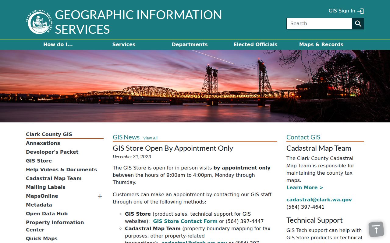
The map should remain a layer-by-layer worksheet. It cannot prove which owner occupies a parcel or which people share a home.
Label Orchards Neighbor Records
Clear labels keep a block file honest. A situs address is where the parcel sits. A mailing address is where tax mail goes. The owner field identifies the person or entity shown on the parcel card. The legal description ties the land to plats and recorded instruments. None is a live occupant roster.
- Taxlot
- A mapped parcel polygon used for land and tax records; it may be a home, road, common tract, or other land.
- PAN
- The Clark property account number used to retrieve the parcel card.
- Situs address
- The physical address assigned to the parcel, distinct from an owner's mailing address.
- Legal description
- The recorded lot, block, plat, or land wording used to follow deeds and covenants.
The research sample shows why labels matter: one Clark parcel has a local site but an owner mailing address in Santa Barbara. The same card links value, zoning, school, and Maple Tree neighborhood fields. Those columns describe different relationships to land and should never be merged into one claim about Orchards neighbors.
Find Orchards Neighborhood Contacts
The Clark County neighborhood association directory is the key community layer for unincorporated Orchards. Enter an address, let the map move to a dot, and click the dot to open the linked neighborhood page. An alphabetical directory is also available. The result is a routing tool, not an association membership database.
| Community layer | Orchards-area use | What to verify |
|---|---|---|
| Maple Tree | Active county neighborhood tied to Orchards Park | Current officers, notices and boundary |
| Greater Brush Prairie | Northern annexation-study area | Current status before calling it active |
| Heritage | Orchards annexation-study subarea | Current GIS boundary and organization status |
| Sifton | Orchards annexation-study subarea | Current county layer, not old plan alone |
| Vancouver neighborhoods | City program with 71 recognized areas | Use only after confirming city limits |
The manifest capture records the directory's address-map route:
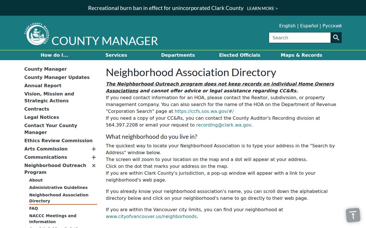
A popup may lead to public officers, meetings, and activity, but it does not identify every household inside the polygon.
Orchards Neighbors Near Maple Tree
Maple Tree's county page is the best documented active community page in the Orchards research. It links neighborhood activity with Orchards Community Park. A 2023 notice used the park as a gathering point, and the current park page notes a 2026 improvement project. These are public community facts, not evidence that any named person lives nearby.
County Program
Neighborhood Relations
564-397-2316
Marilee McCall
marilee.mccall@clark.wa.gov
Maple Tree
County neighborhood page
Use the address popup for the current boundary, officers, and meeting notices.
Orchards Park
Community meeting anchor
9800 NE 54th St
Vancouver, WA 98662
The county map should decide which page fits the target address. Do not assign Maple Tree to every Orchards block. A neighborhood name may differ from the ZIP, mailing city, school area, utility district, and municipal boundary.
Trace Orchards Block Covenants
Clark County expressly says it does not keep HOA records or CC&Rs. That statement corrects a common myth. The neighborhood map cannot supply private member lists or covenant files. Recorded declarations, covenants, easements, plats, and amendments belong in the Auditor's LandmarkWeb index. Association entity filings may appear in the Secretary of State CCFS.
Start with the parcel's subdivision and legal description. Search the Auditor for the plat and declarations, then follow later amendments and releases. If an association name appears, check its UBI and status in CCFS. A registered-agent address is a service contact and may not be an office or a neighbor's home.
For an unrecorded contact, use the association's own public page or manager. Preserve the difference between a recorded land restriction, an organization filing, and a voluntary neighborhood association. Each has a distinct custodian and purpose.
Note: The county neighborhood directory routes an address to a public community page; it does not maintain HOA membership or CC&R records.
Use Orchards Voter Fields Carefully
Washington voter data includes a defined public set under RCW 29A.08.710: name, address, political jurisdiction, gender, year of birth, voting record, registration date, and registration number. Original forms are confidential. Protected-voter and Address Confidentiality Program records may be withheld or use a substitute address.
For a single participant who provides a matching name and birth date, use VoteWA. Clark Elections handles local help and archives, while statewide lists and reports route to the Secretary of State. A displayed voting record does not disclose ballot choices or prove a person's beliefs.
Block research should lead with geography, not a list of names. First identify the precinct, county, city boundary, and neighborhood. Then inspect only the public fields required for a lawful civic question. Registration can change, so save the access date. An absent result can reflect an exact-match issue or protection rather than a negative fact.
Compare Orchards Neighbor Sources
Official rolls and commercial neighbor tools answer different questions. County records expose their custodian, field meaning, update context, and request route. Commercial products may merge old addresses, phone data, relatives, and names without showing when or why the link was made. Treat that kind of result as an unverified lead and return to the official source.
| Source type | Strength | Main limit |
|---|---|---|
| Clark GIS and PIC | Parcel geometry and dated owner fields | Ownership does not prove occupancy |
| Auditor index | Recorded instruments and parties | An index or image is not always certified |
| Neighborhood page | Public boundary, contacts and activity | Not a member or household roll |
| Commercial category | May suggest spelling or an old address | Source dates and merged identities may be unclear |
For Orchards neighbors, the smallest official fact is usually the best fact. Cite the parcel, neighborhood page, or public contact rather than publishing a combined personal profile.
Protect Privacy Around Orchards Neighbors
Public parcel and neighborhood records do not create a right to watch people or expose their private routines. Household members, visitors, delivery details, utility accounts, and unlisted contacts are not supplied by the Clark parcel roll. A protected voter may be absent, and an ACP participant's actual address is confidential under Washington law.
Washington has no one opt-out that removes a person from all custodians. Corrections and protections follow the record type. Address safety concerns go through the Washington Address Confidentiality Program or the originating agency. A parcel error belongs with the Assessor, a recorded document with the Auditor, and a voter-field question with Elections.
Lawful use. Research Orchards neighbors only for a lawful block, property, family, safety, or civic purpose. Never stalk, harass, threaten, impersonate, or harm a person.
End a block note with the source, access date, record role, and limit. “Owner of record on the parcel card” is precise. “Lives next door” is unsupported unless a lawful, current source directly proves it.